Seattle's Scenic Drive to Nowhere
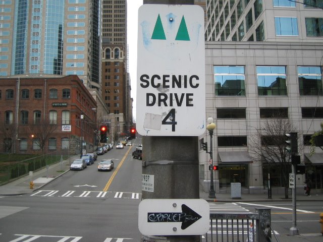 If you exit the Alaska Way Viaduct's northbound lanes at Seneca Street, you'll see this sign just before the First Avenue stoplight. Then, if you turn right on First (as the sign indicates), five blocks down you'll see another such sign, at Cherry Street.
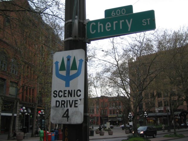 Continuing south, you won't see any more of these signs before hitting Tierra del Fuego.
Obviously they're signposts for a self-guided scenic drive, I'm guessing for a route laid out in the '60s or '70s (judging by the signs' design and font), perhaps an imitation of the more popular San Francisco 49-mile Scenic Drive. I'm also guessing that most of Seattle's other scenic drive signs were phased out/removed/stolen/whatever over time, as the two here seem to be obsolete relics.
But I'm curious. Does the "4" on these signs mean there were at least four designated scenic drives around town? Was there a corresponding map to go along with the drive(s), published by the city or county? Do the cool, trident-shaped blue arrows pointing through the iconic evergreens represent alternate routes? I'd love to reconstruct the route(s) and drive it/them myself -- I'll see what I can dig up at the library, and post my findings at a later date.
***
Labels: Scenic Drives
posted by Steve @ 12:25 PM
3 Comments
![]()
![]()
3 Comments:
There's another one of these signs on 99 just north of the West Seattle Bridge and before the exits for downtown.
...and another in West Seattle on Alki Ave SW. Also has the number 4.
There were four scenic drives. There is a scanned copy of a map that shows all the scenic routes on Flickr.
Post a Comment
Subscribe to Post Comments [Atom]
<< Home