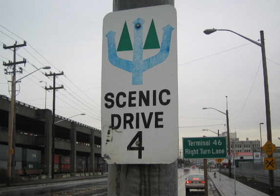
Another Scenic Drive Sign!

Perhaps I'll do a 2014 update to see which Scenic Drive signs I know of are still out there.
***
Labels: Scenic Drives
posted by Steve @ 9:43 PM
0 Comments
![]()
![]()
Perhaps I'll do a 2014 update to see which Scenic Drive signs I know of are still out there.
***
Labels: Scenic Drives
posted by Steve @ 9:43 PM
0 Comments
![]()
![]()
 Alright.
Labels: Scenic Drives
posted by Steve @ 6:55 PM
2 Comments
![]()
![]()
Labels: Scenic Drives
posted by Steve @ 4:17 PM
1 Comments
![]()
![]()
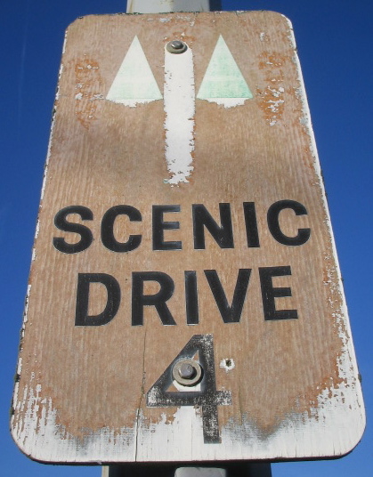 In my ongoing quest to retrace Seattle's Scenic Drives, today Eliza and I motored along what appears to be Scenic Drive 4, the mustard- colored route in the southern half of our outdated, non-detailed map. We were surprised to find nine signs we hadn't seen before -- nowhere near enough to follow the route by sign alone, but far more than we expected. Curiously, they were along just one stretch of the approximately 25-mile drive, all in West Seattle, from Hamilton Viewpoint to Fauntleroy Park. Among them were newer metal signs like we'd seen before, as well as older wooden ones like the weathered specimen here. Also, on the last sign we saw, the arrow pointed in a different direction from what the map indicated. We followed both routes, just to cover the bases.
Labels: Scenic Drives
posted by Steve @ 8:25 PM
0 Comments
![]()
![]()
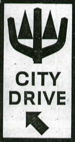 “Follow the 'Trident and Trees' markers to see Seattle’s many delightful scenic attractions.”
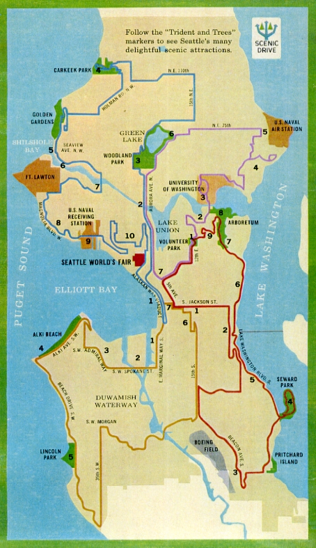 "City Drive" was changed to “Scenic Drive,” otherwise, that same year the design appeared on 12-by-24-inch route markers installed along 117 miles of city streets. A corresponding color-coded map was created; the one above -- with the "Scenic Drive" image in the upper-right corner -- appeared in a souvenir booklet from the 1962 Seattle World's Fair. It shows four routes, one for each approximate quadrant of the city. Click on the map for a larger view; print it out, along with the descriptions below, and take 'em along on your own self-guided tour!
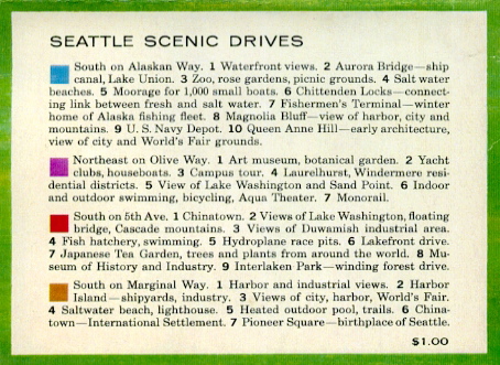 Questions remain: How many of these signs are still posted? When were the original 3/8-inch-thick plywood signs replaced with the metal ones we see today? Are missing signs ever replaced anymore, or will they continue to disappear over time? When did the city apparently stop promoting the Scenic Drives?
 Labels: Scenic Drives
posted by Steve @ 12:29 AM
0 Comments
![]()
![]()
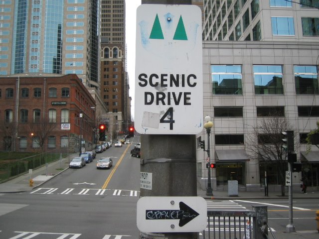 If you exit the Alaska Way Viaduct's northbound lanes at Seneca Street, you'll see this sign just before the First Avenue stoplight. Then, if you turn right on First (as the sign indicates), five blocks down you'll see another such sign, at Cherry Street.
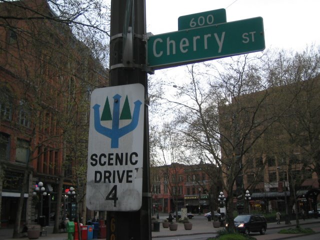 Continuing south, you won't see any more of these signs before hitting Tierra del Fuego.
Labels: Scenic Drives
posted by Steve @ 12:25 PM
3 Comments
![]()
![]()